Skip to main content
menu
menu
EN
English
EN
English
GA
Gaeilge
login
Login to Portal
Register
Login to Portal
Register
Home
Consultations
Surveys
Applications
Home
Consultations
Project Carlow 2040: A Vision for Regeneration
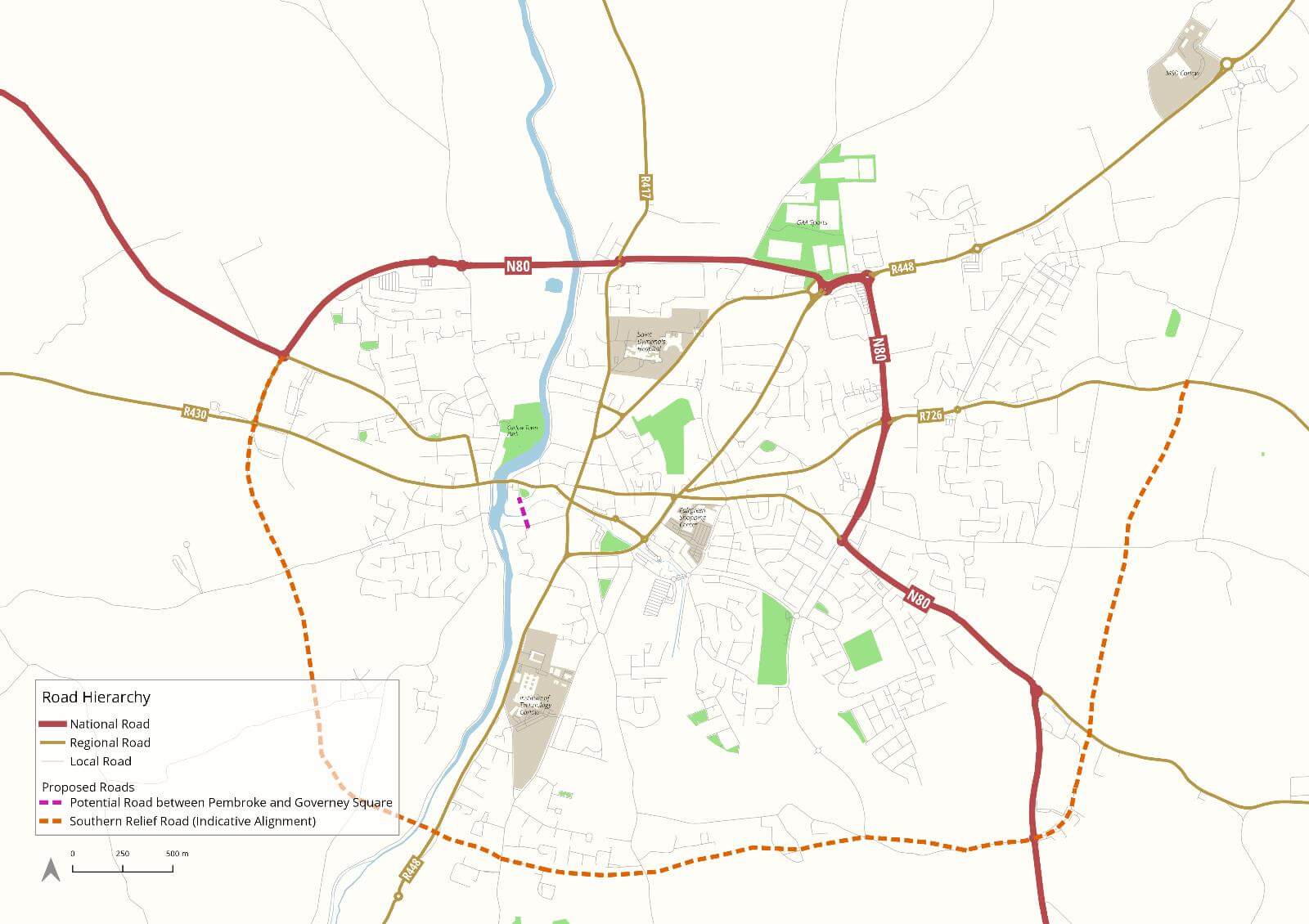
Map 1: Carlow Town – Existing and Proposed Roads
Map 1: Carlow Town – Existing and Proposed Roads
Project Carlow 2040: A Vision for Regeneration
Closed
date_range
28 Sep, 2020, 13:00
-
26 Oct, 2020, 17:00
Click map to enlarge
Share
Contents
Home
Executive Summary
Introduction
Public Consultation
Strategic Policy
Vision & Guiding Principles
keyboard_arrow_right
Regeneration Action Plan
1. Economics and Investment
2. Transport and Movement
3. Health and Well-being
4. Environment and Sustainability
keyboard_arrow_right
Urban Design & Implementation
1. Town Centre
2. Cultural Quarter
3. Barrow Track / Civic Spine
4. Pembroke District
5. The Burrin Riverfront
6. Link Streets (Dublin St. & Tullow St.)
keyboard_arrow_right
Appendices
Appendix I Urban Design Principles
keyboard_arrow_right
Appendix II Transport and Movement Maps
Map 1: Carlow Town – Existing and Proposed Roads
Map 2: Existing Cycling Infrastructure
Map 3: Existing Public Transport
Map 4: Carlow Town Centre Circulation and Proposed Upgrades to Junctions
Map 5: Walking and Cycling Links – Overall Map
Map 6: Walking and Cycling Links – Town Centre
Map 7: Walking and Cycling Links – IT Carlow Area
Map 8: Planned Town Bus Routes
Map 9: 5-10min walking catchment to proposed Bus Town Stops
Map 10: 5-10min cycling catchment to proposed Bus Town Stops
Appendix III Bibliography
Appendix IV Visual Key Plan
Dashboard
View graphs and filter submission data for this consultation