See attached. In summary:
1. The proposed realignment of the zoning boundaries at Lidl, Tullow Road to include adjoining Commercial lands is welcomed (Amendment no....
Chapter 15: Town and Village Plans / Settlement Boundaries
Closed23 Feb, 2022, 09:00 - 23 Mar, 2022, 16:30
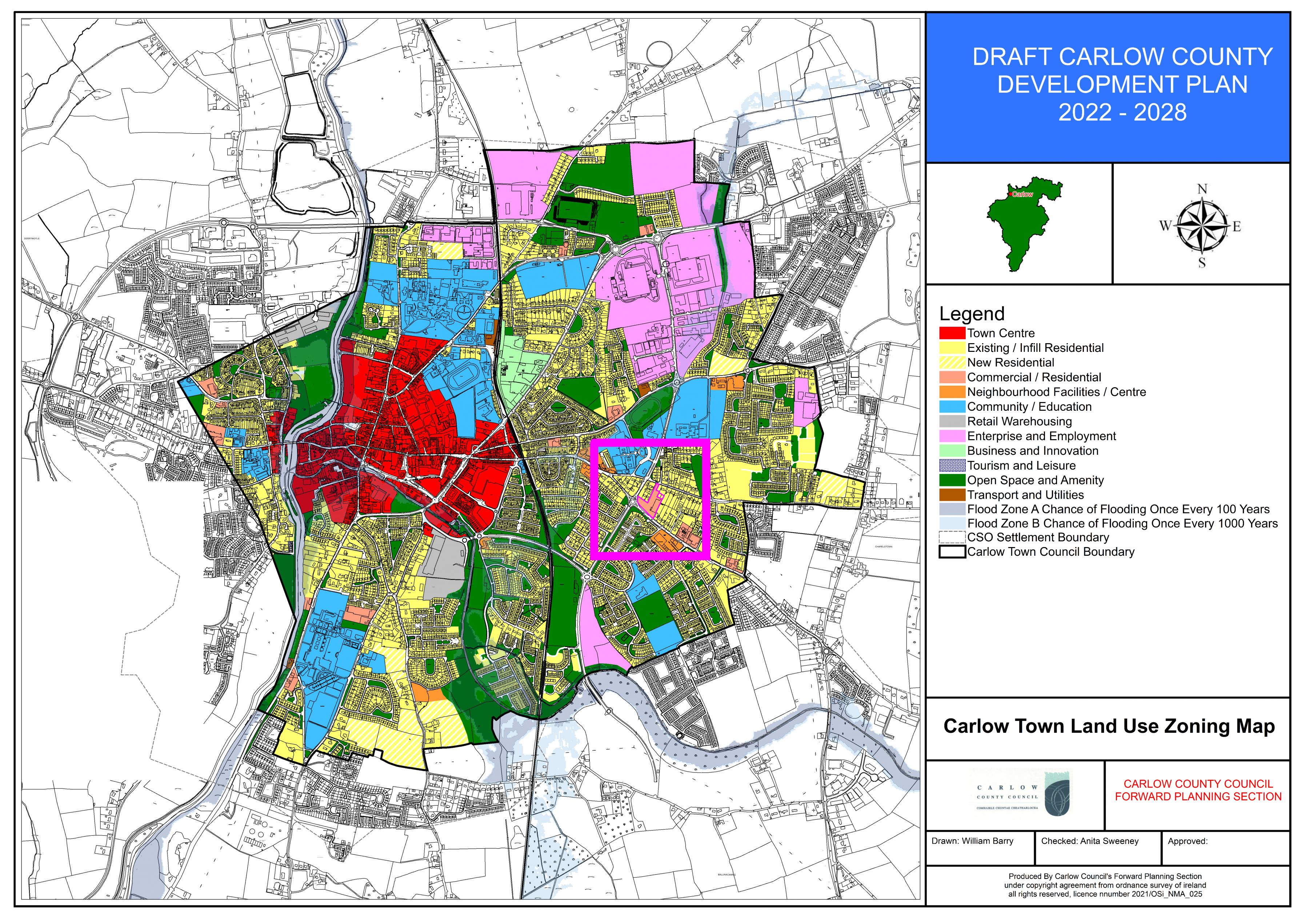
Section 15.1 Key Town – Carlow Town
(Amendment No. 107) Insert new section and policy after Section 15.1, new text in green as follows:
15.1.1 Flood Risk Management – Carlow Town
The flood risk mitigation measures and justification tests for Carlow Town are detailed in Section 7.11 and Section A.4 of the Strategic Flood Risk Assessment (SFRA) prepared as part of this County Development Plan (See Appendix III). General guidance on development management and flood risk is set out in Section 6 of the SFRA.
Flood Risk Management – Carlow Town - Policy
It is the policy of the Council to:
CW. P1: require the following flood risk mitigation measures to be implemented in Carlow Town:
- Defended Town Centre lands: Flood risk to be mitigated by raising ground levels to achieve appropriate finished floor levels.
- Undefended Town Centre lands: Development is to be restricted to existing vulnerability use and extensions/refits/changes of use.
- Enterprise & Employment 2 lands (Ref: SFRA Section A4.5 Knocknagee Stream downstream of Castle Oaks area) No less vulnerable development to take place in Flood Zone A.
- Community & Educational/Commercial and Existing Residential lands downstream of Castle Oaks: Development restricted to extensions renovations and changes of use.
- Existing Residential/Enterprise & Employment in Mill Race/Springfield area to south of Town: Development restricted to extensions renovations and changes of use.
-
Town Centre and Existing Residential to the west of the Barrow: Development restricted to extensions renovations and changes of use in undefended areas, while in defended areas flood risk to be mitigated by raising ground levels to achieve appropriate finished floor levels.
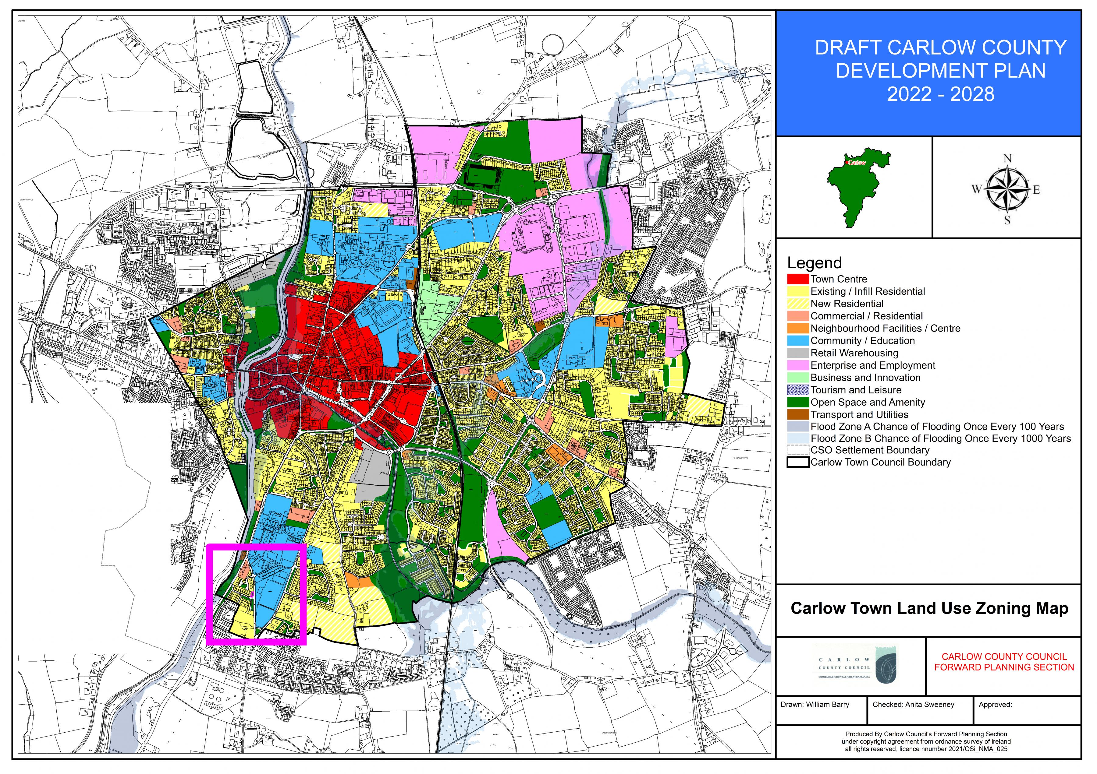
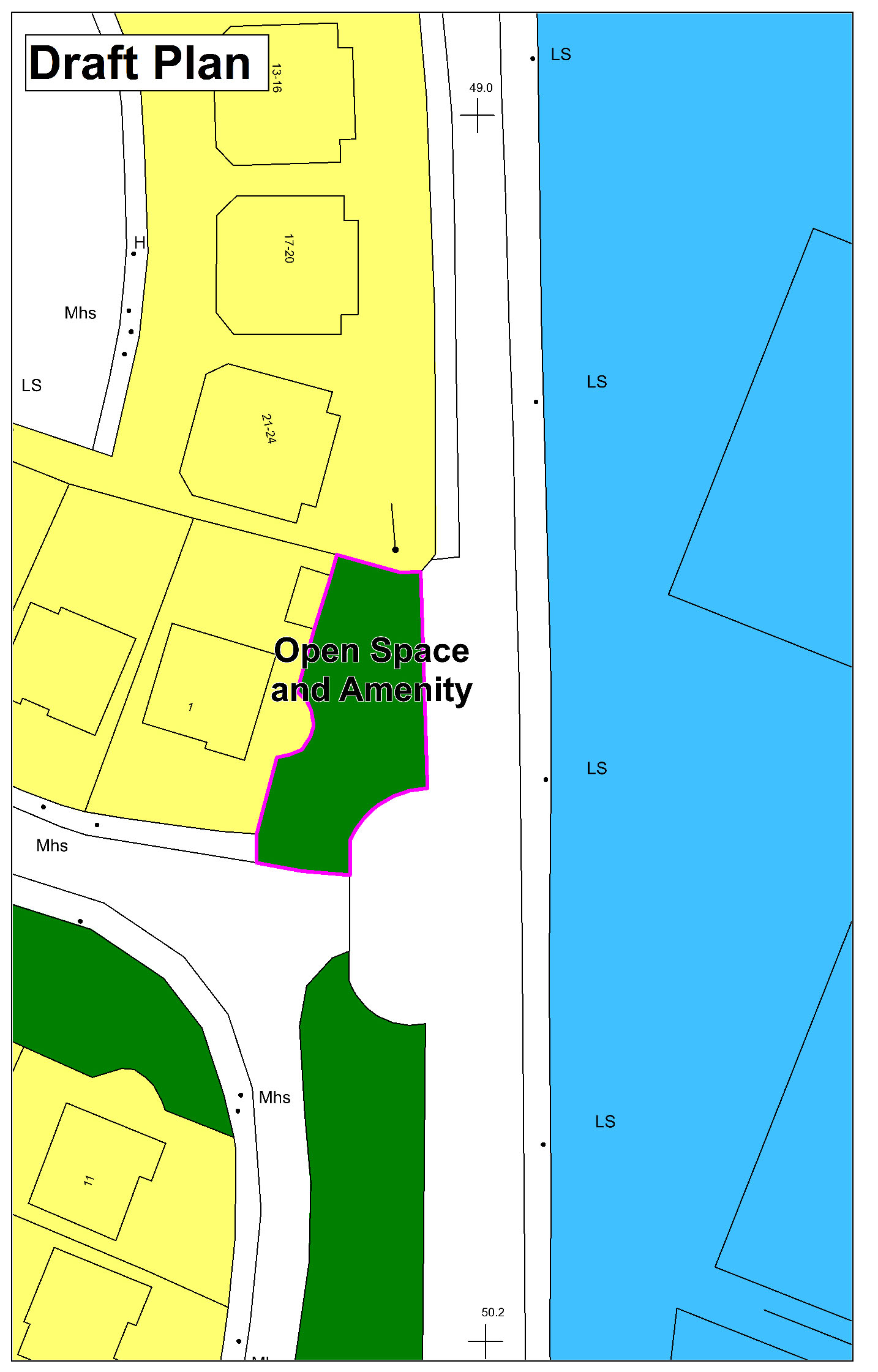
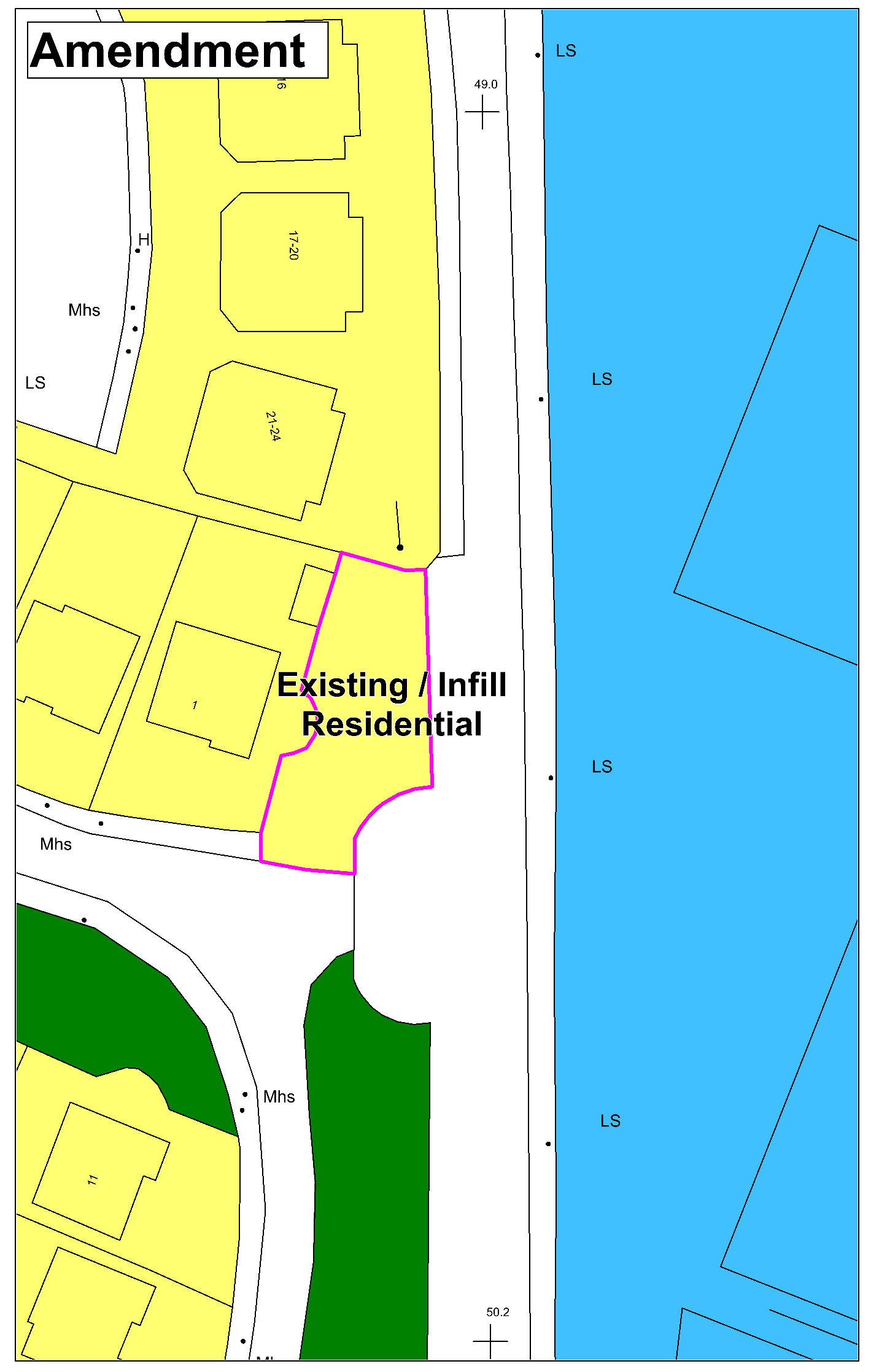
(Amendment No. 108) Amend Carlow Town Land Use Zoning Map to rezone land at Southern Gardens from ‘Open Space and Amenity’ to ‘Existing/Infill Residential.
|
|
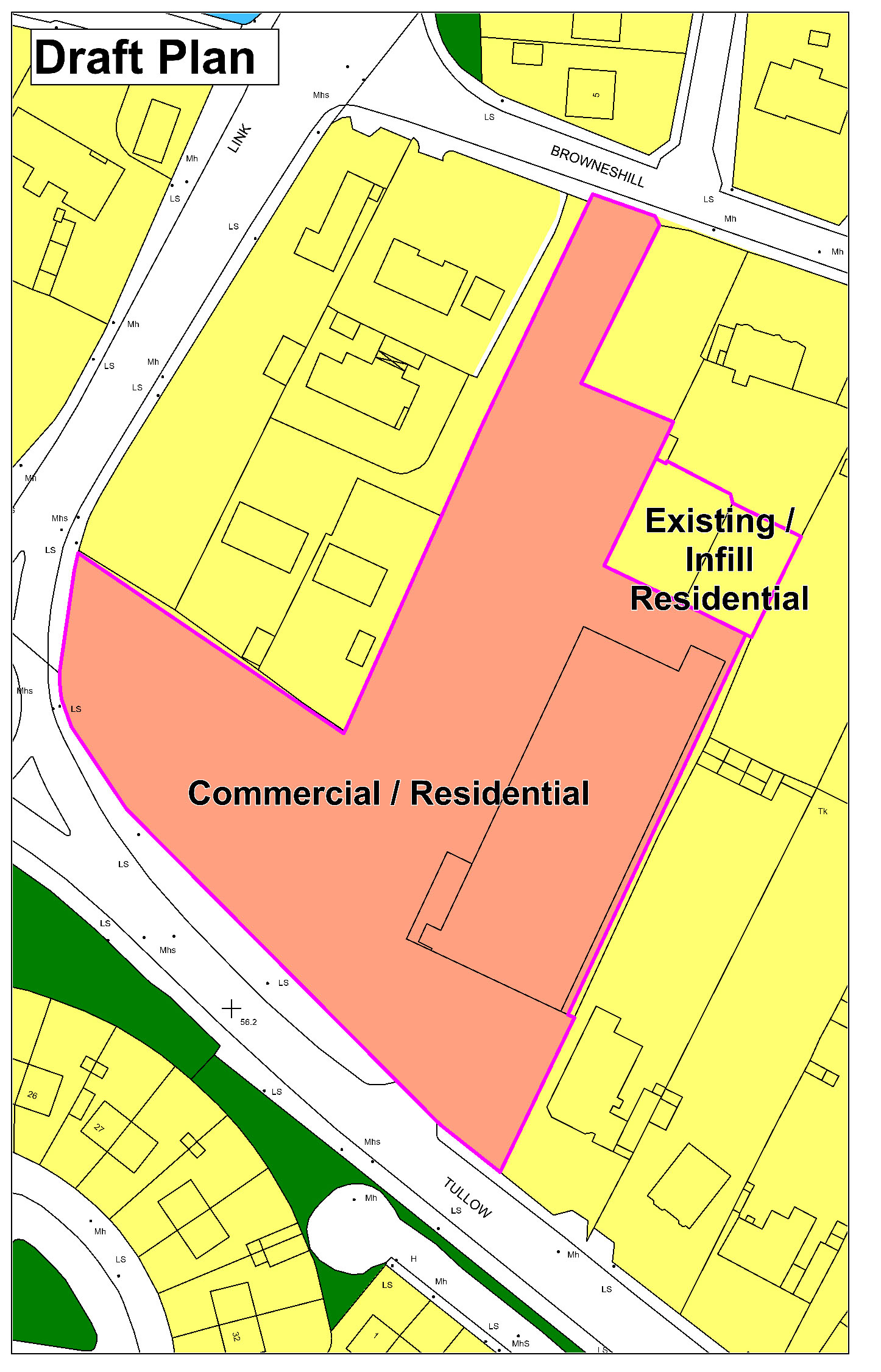
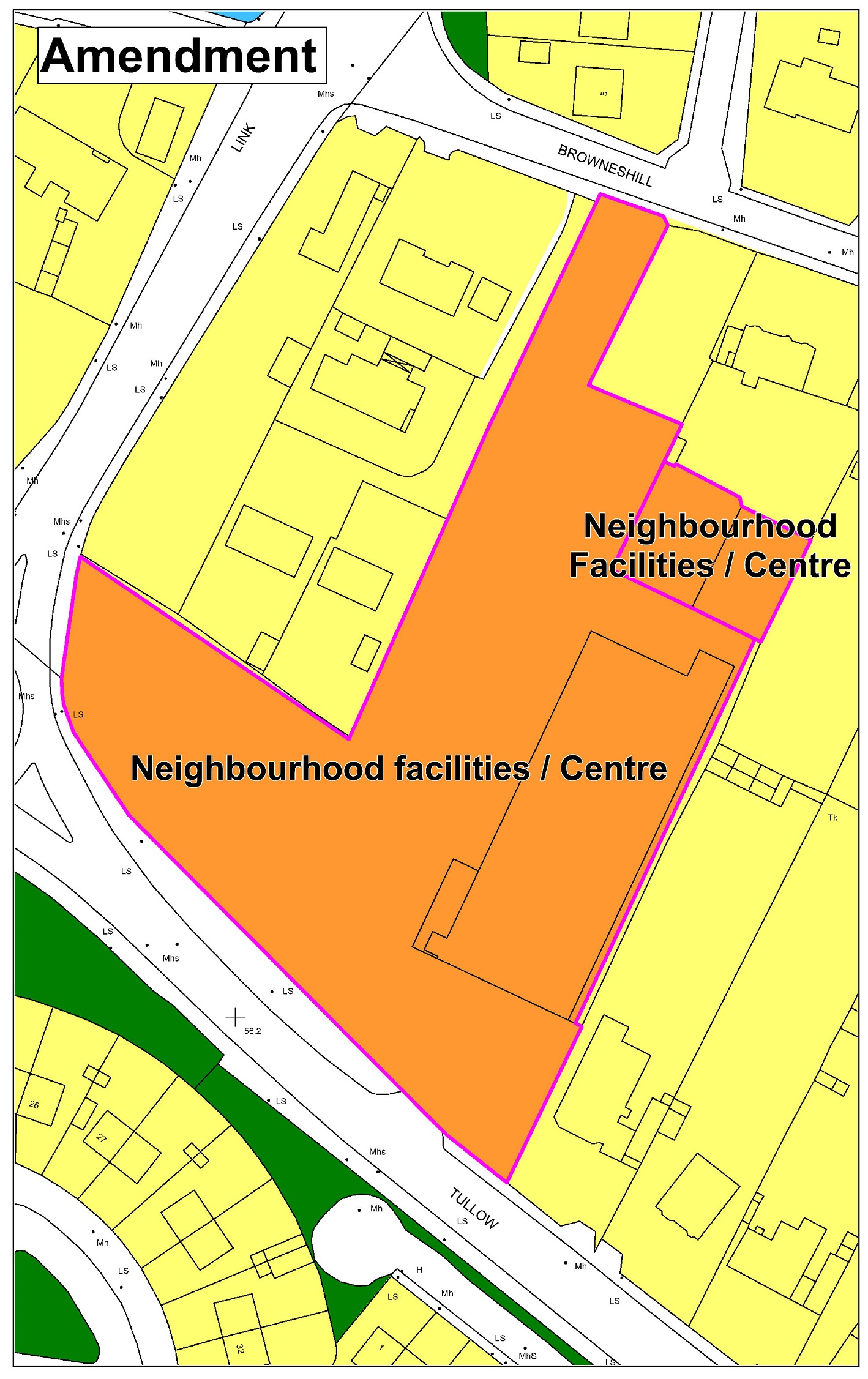
(Amendment No. 109) Amend Carlow Town Land Use Zoning Map to rezone portion of land adjoining Lidl store from ‘Existing/Infill Residential’ to ‘Commercial/Residential’, and re-designate enlarged site from ‘Commercial/Residential’ zoning to ‘Neighbourhood Centre’ zoning.
|
|
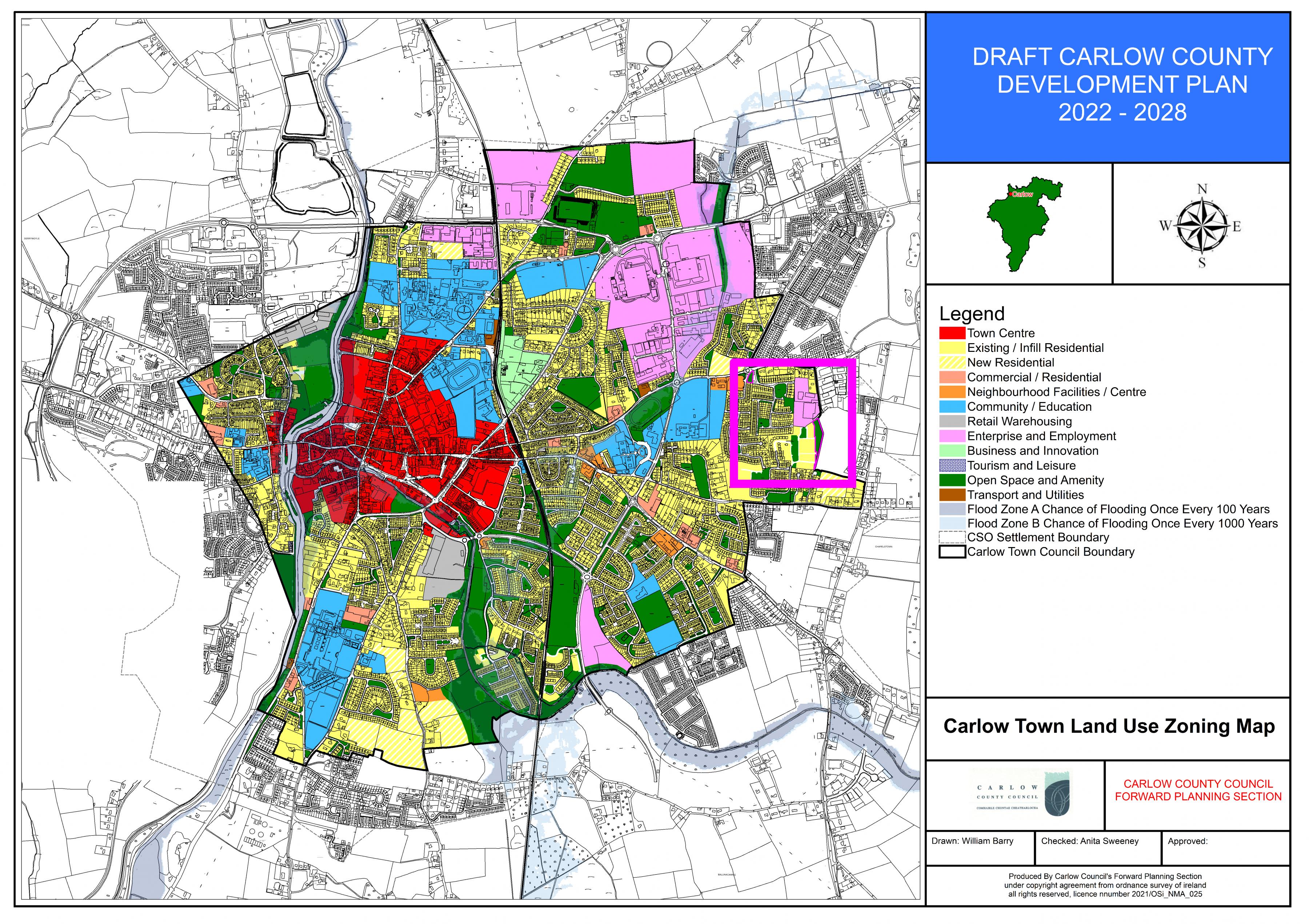
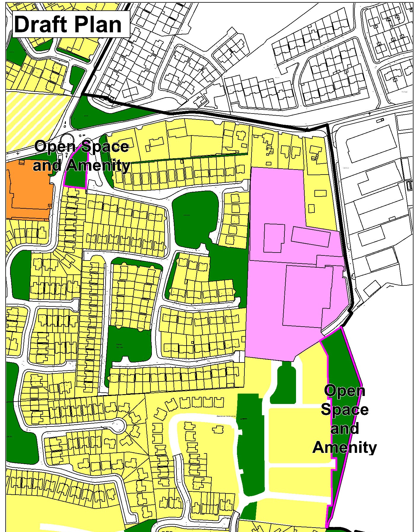
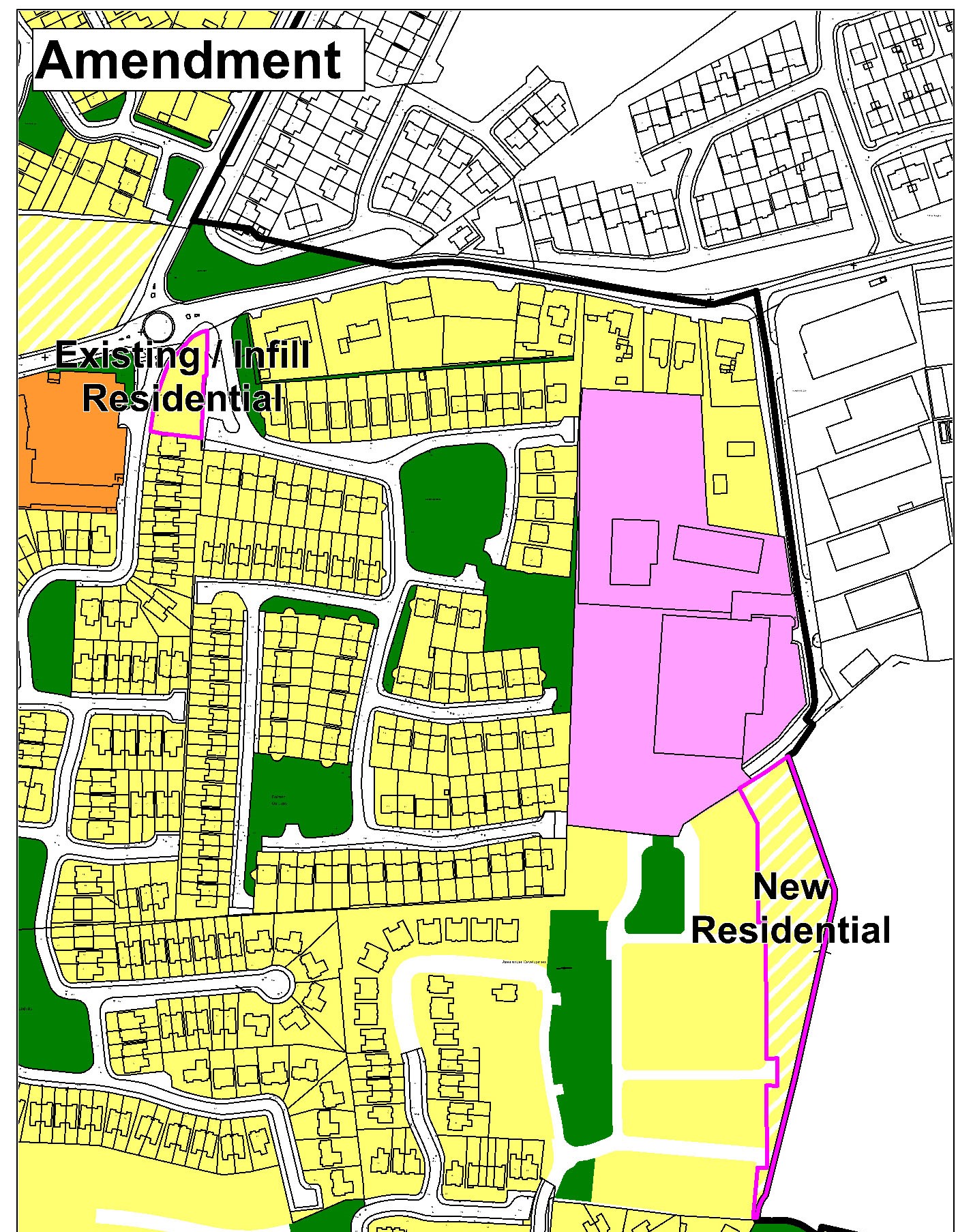
(Amendment No. 110) Amend Carlow Town Land Use Zoning Map to rezone portion of land on Hacketstown Road from ‘Open Space and Amenity’ to ‘Existing Residential Infill’, and to rezone land adjoining Brownshill Rise from ‘Open Space and Amenity’ to ‘New Residential’.
|
|
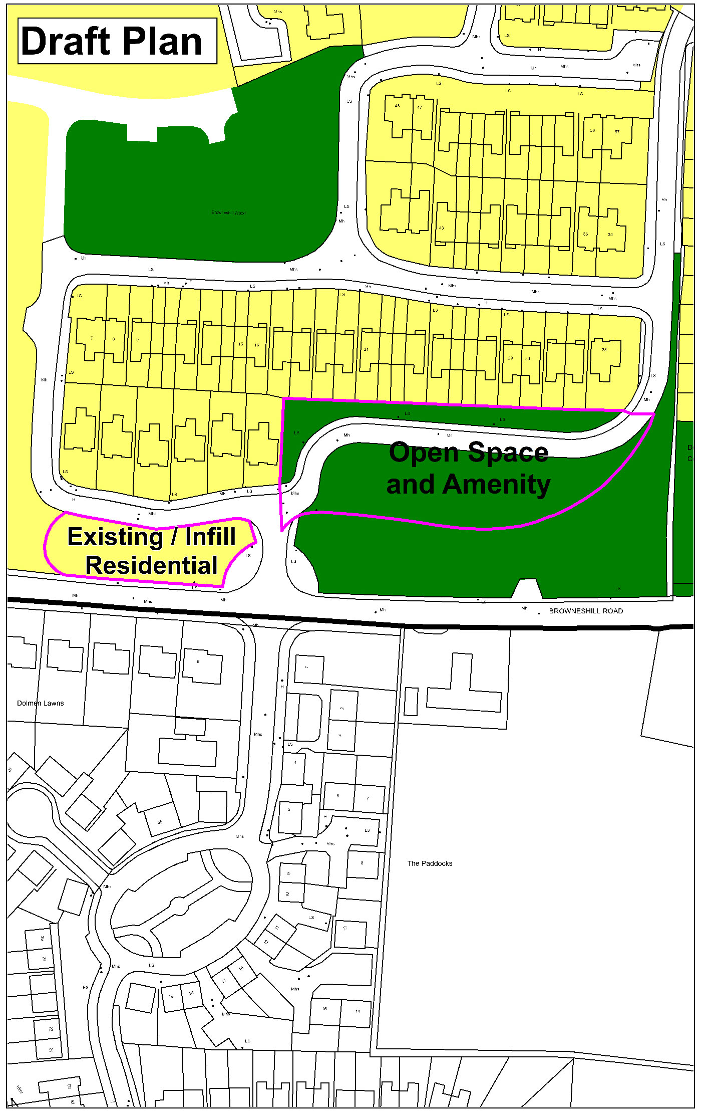
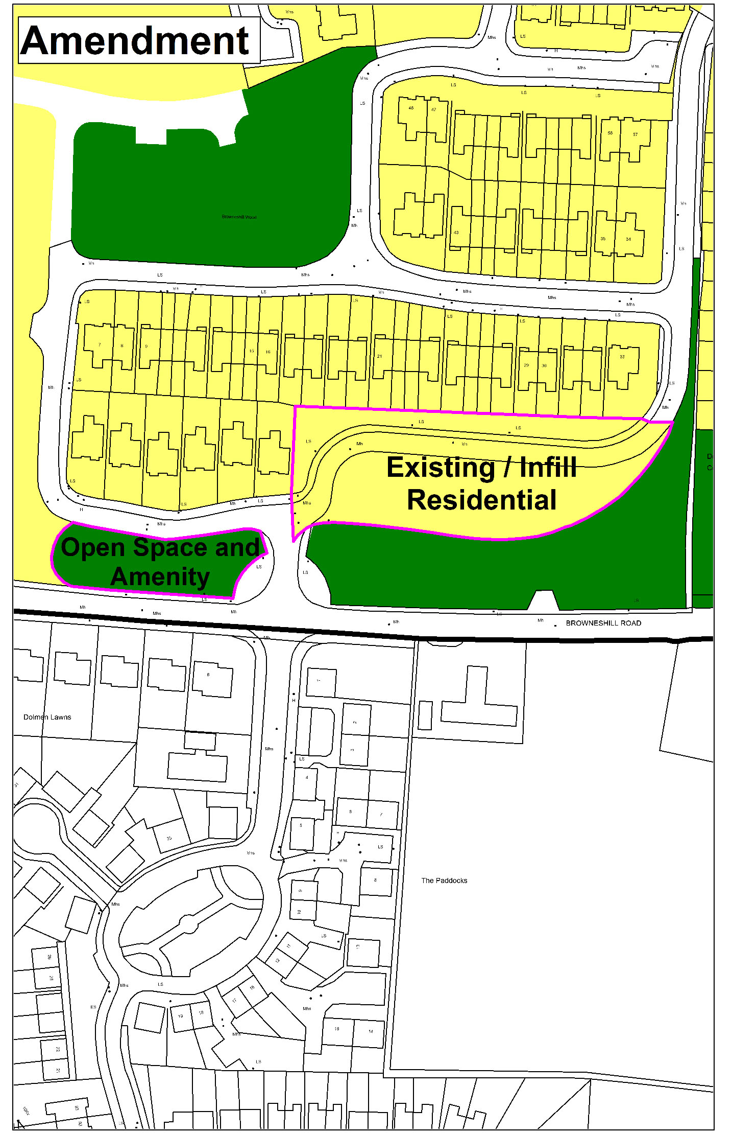
(Amendment No. 111) Amend Carlow Town Land Use Zoning Map to rezone portion of land at Browneshill Wood from ‘Open Space and Amenity’ to ‘Existing Residential/Infill’ and insert a new corresponding specific objective that Redevelopment of this site shall be subject to relocation of the access road to front any new development proposed and shall be fully located within the lands zoned existing residential / infill, and amend Carlow Town Land Use Zoning Map to rezone portion of land at Browneshill Wood from ‘Existing Residential/Infill’ to ‘Open Space and Amenity’.
|
|
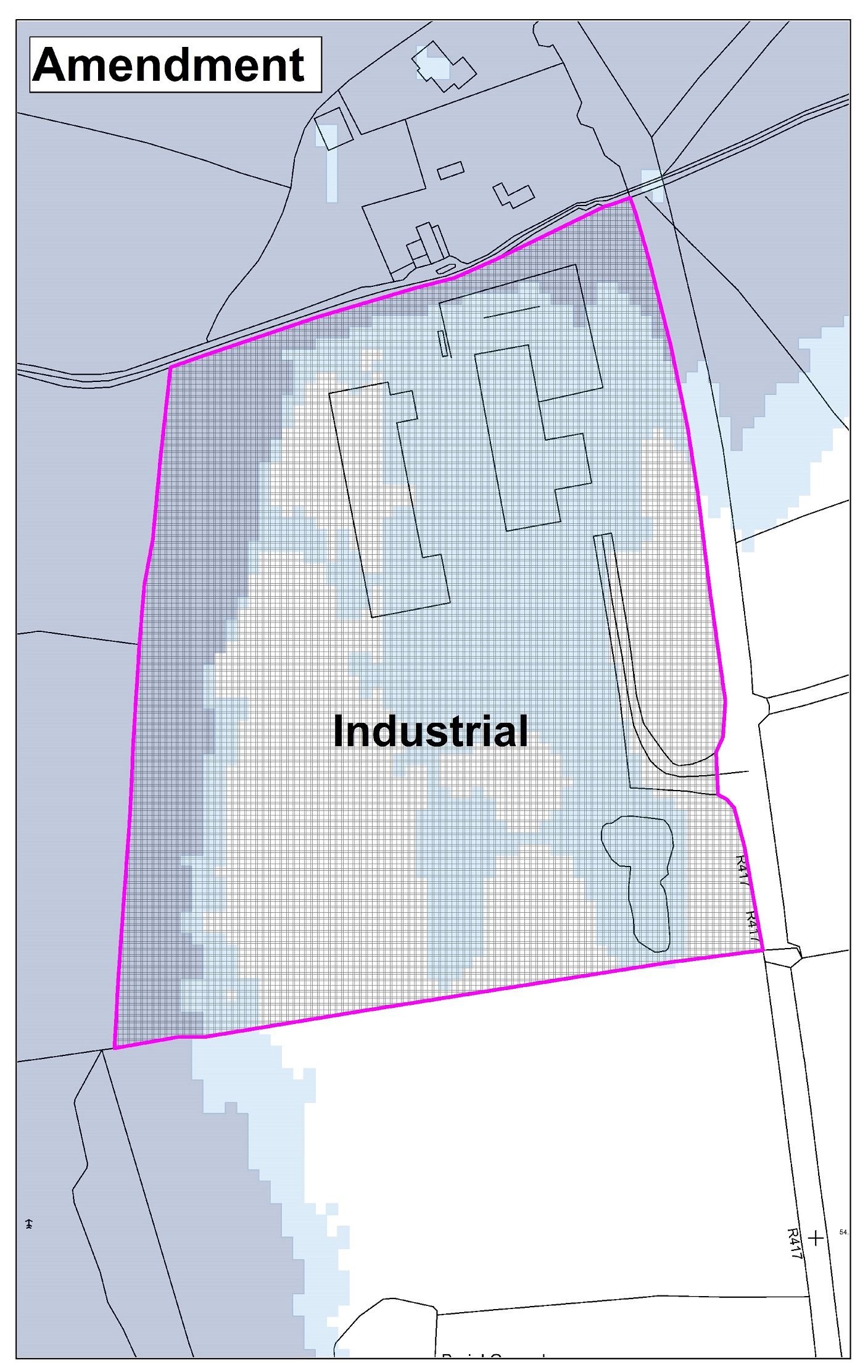
(Amendment No. 112) Amend Carlow Town Land Use Zoning Map to zone land at Newacre, Athy Road for ‘Industrial’ use.

|
|
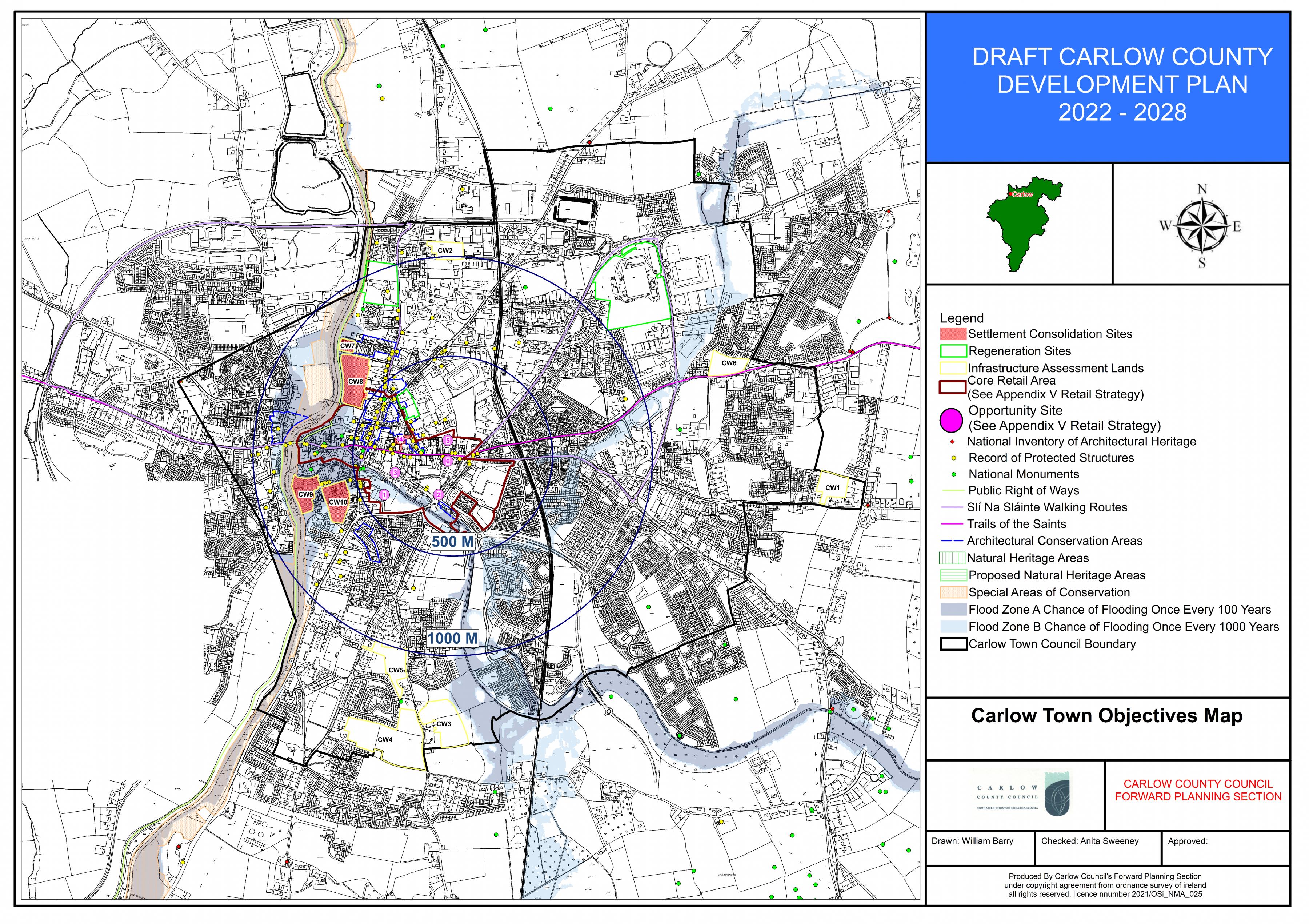
(Amendment No. 113) Amend Carlow Town Objectives Map to highlight areas that will contribute to meeting compact growth target of 30%, to identify settlement consolidation sites, regeneration sites, and to outline core retail areas and retail opportunity sites detailed in the Draft County Retail Strategy.
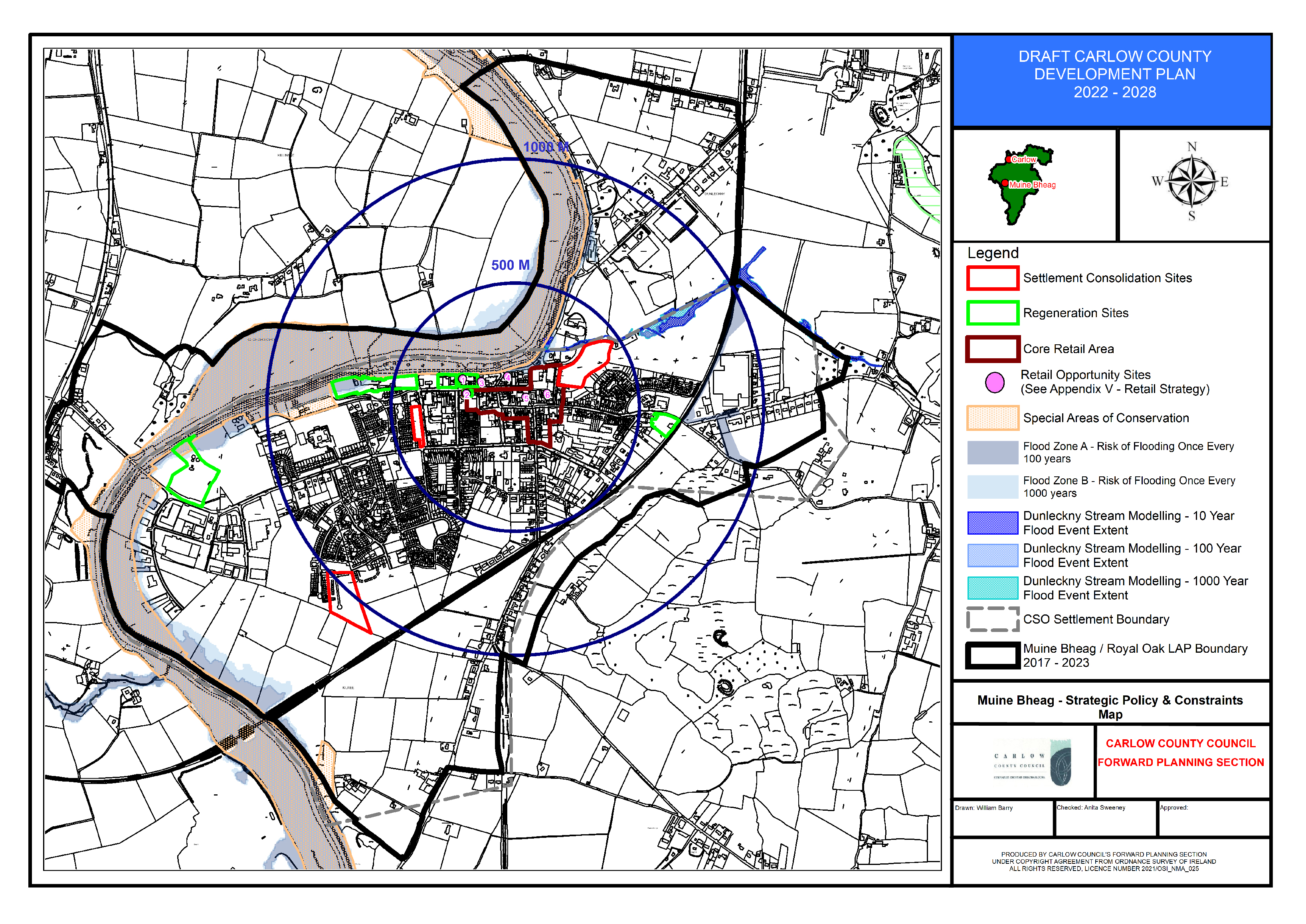
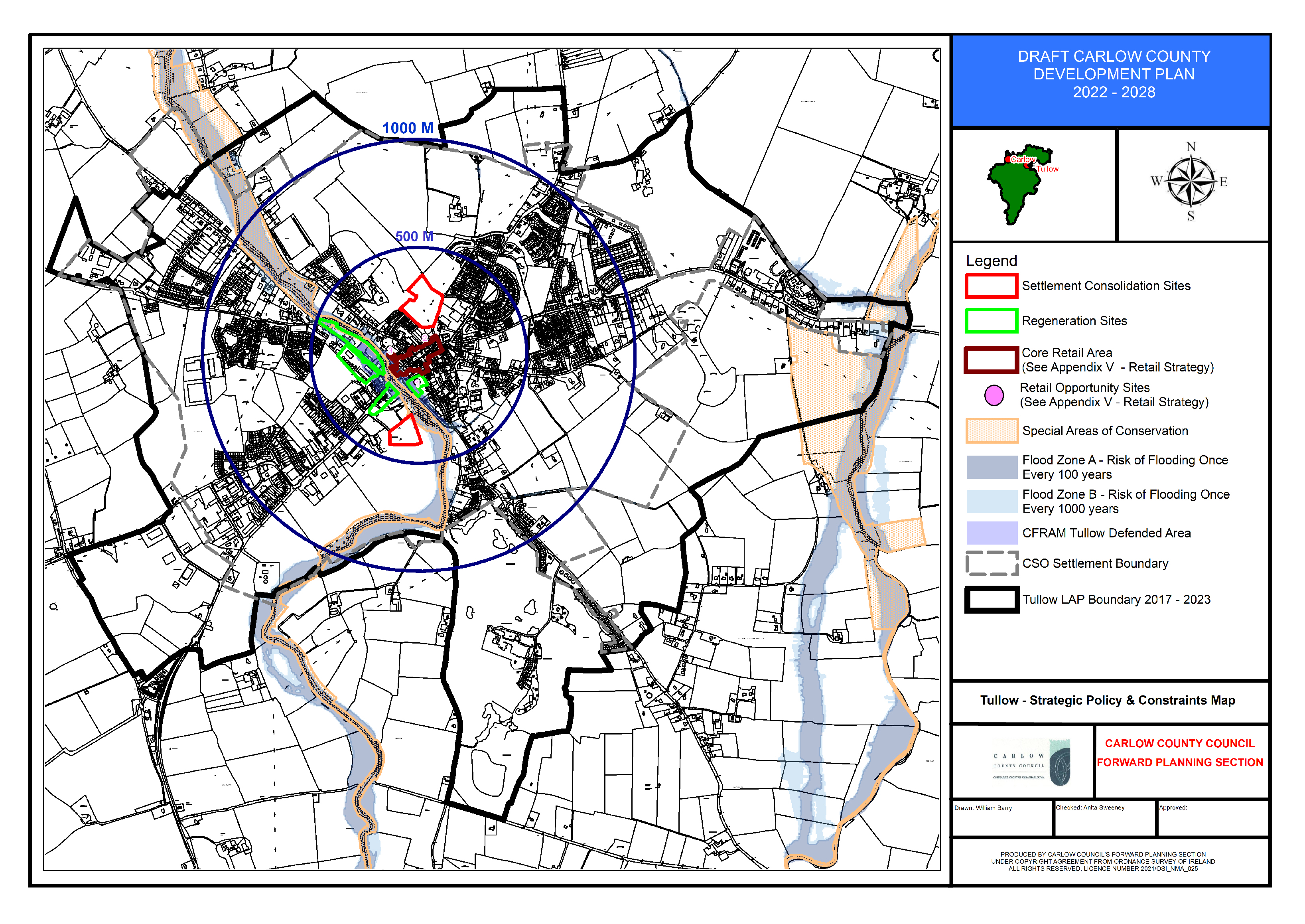
Section 15.2 District Towns - Tullow and Muine Bheag
(Amendment No. 114) Insert Strategic Policy and Constraints Maps for Tullow and Muine Bheag to highlight areas that will contribute to meeting compact growth target of 30%, to identify settlement consolidation sites, regeneration sites, and to outline core retail areas and retail opportunity sites detailed in the Draft County Retail Strategy.
Contents
Observations
Observations